Managing an irrigation system in a densely populated area like Jakarta is no easy task. Accurate, up-to-date, and reliable spatial baseline data is required to support effective water resource planning and management.
To address this need, Geo Survey Persada Indonesia (GSPI) was entrusted by the Jakarta Water Resources Management, Investigation, Testing, and Measurement Unit (UP4SDA) to conduct an Aerial Photography Survey and LiDAR in South and East Jakarta. This project covered an area of 13,355.4 hectares and was implemented over 70 working days. The primary goal was to produce high-quality geospatial data that could be directly utilized by the Technical Division and the Jakarta Water Resources Sub-Department.
The series of works are carried out systematically to ensure accuracy and efficiency, including: installation and measurement of control points, LiDAR data collection and aerial photography, and geospatial data processing.
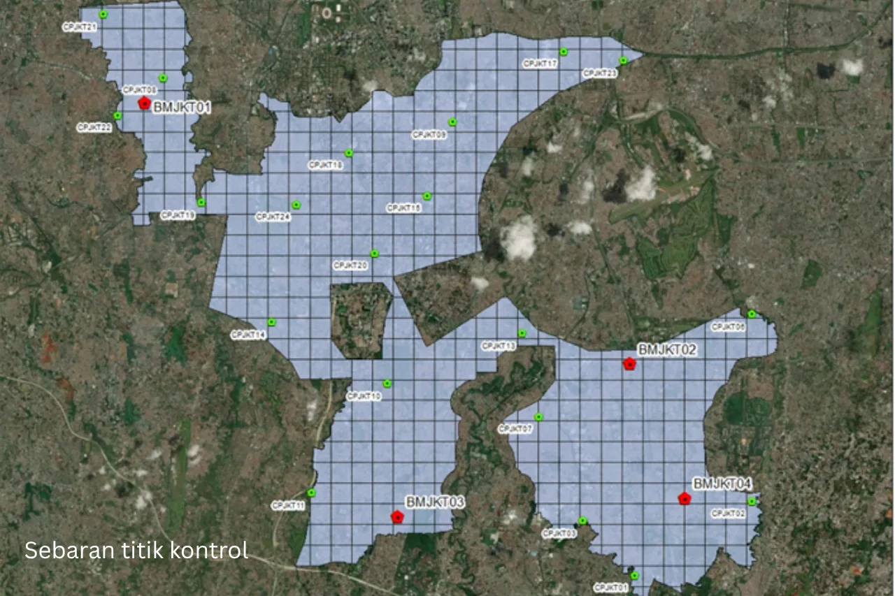
A total of 24 control points are planned in this work, consisting of 4 Benchmarks (BM) and 20 Control Points (CP). The control points are in the form of postmarks placed on objects that are easily recognized from the air, in order to facilitate the process of aerial triangulation and geometry correction. Control point measurements are carried out using a Geodetic GNSS tool with a minimum specification of dual frequency, which is tied to BIG's CORS. The coordinate system used is WGS 1984 UTM Zone 48S, with an ellipsoid and orthometric height system.
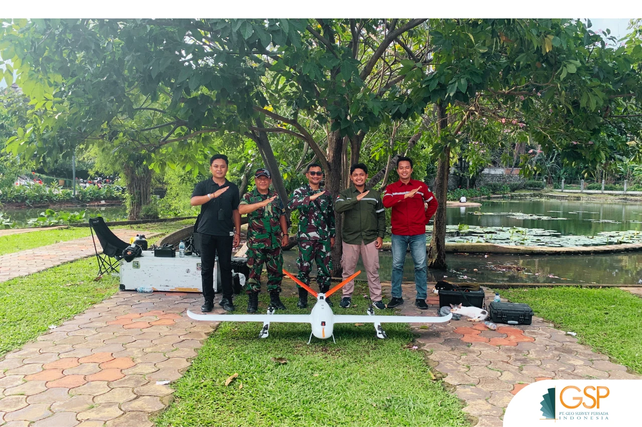
Aerial photo and LiDAR acquisition was carried out over 21 days, utilizing UAV technology and high-accuracy sensors to produce accurate and detailed data, including:
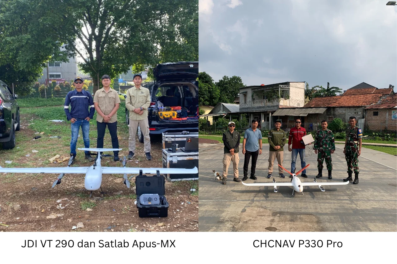
- UAV CHCNAV P330 Pro for aerial photo acquisition.
- UAV JDI VT290 with Satlab Apus-MX sensor **for LiDAR data acquisition.
Both platforms enable high-resolution data acquisition over a wide area in a time-efficient manner, without sacrificing the quality of the results.
From this survey activity, GSPI produced a complete set of geospatial data that can be directly utilized in irrigation technical planning, including: raw aerial photography data with geotags in UTM coordinates, raw GPS observation data with intervals <1 second, classified point cloud data, measurement forms and control point descriptions complete with stake photos, a list of control point coordinates, as well as Orthomosaic, DTM, DSM, and contour files.
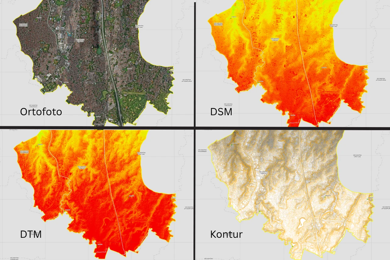
Orthophotos are obtained from aerial photography processing using Agisoft Metashape. This orthophoto product has a Ground Sampling Distance (GSD) of 4 cm, with a horizontal accuracy (CE90) of 0.043 meters. Based on PERBIG Number 18 of 2021, this accuracy falls within Class 1 for 1:1,000-scale maps.
Meanwhile, LiDAR data produces a point cloud, a collection of dense dots that represent the ground surface and objects on it. This point cloud data is then corrected and classified into two main classes: ground and non-ground. The resulting point cloud density reaches over 100 points per square meter. The vertical accuracy test (LE90) results for the control points showed a value of 0.024 meters, which also meets the Class 1 accuracy requirement for a 1:1,000 scale map according to the PERBIG standard.
From the classified point cloud data, a Digital Surface Model (DSM) was modeled using a combination of ground and non-ground data exported in raster format. Furthermore, the manually edited ground-classed point cloud was used to create a Digital Terrain Model (DTM), a representation of the pure land surface without any objects on it, such as buildings or vegetation.
From the DTM data, a contour extraction process is performed to produce a topographic model of the land surface. Contours are created at 0.25-meter intervals and exported as contour lines as one of the final products of the project.
For GSPI, delivering efficient and highly accurate results is a top priority.
Through an irrigation mapping project with UP4SDA DKI Jakarta, GSPI has demonstrated that LiDAR and aerial photography technology can produce high-precision spatial data ready to support irrigation system planning and management.
With the support of the latest technology and an experienced team of professionals, Geo Survey Persada Indonesia remains committed to providing accurate, efficient, and reliable survey services for the advancement of water resources infrastructure in Indonesia.
Contact Geo Survey Persada for more information about LiDAR and aerial mapping services!
📞 081390787507 (GSPI Sales Engineer)
Flying Higher, Mapping Wider